
Flying into hail storms for weather forecasting research
This is an all out exploration of hail storms from the ground up. Our data from aloft will be combined with the data on the ground, which is also combined with radar trucks away from the storm. In the end, meteorologists will have a complete profile of the storm and its inner workings." - Brian Argrow
Follow the field campaign @CU Engineering on Instagram.
Hail Field Day
Sat., May 17, 2025. 2-4 p.m.
See all the scientific instruments deploying on the ICECHIP Campaign
Come See:
- Doppler on wheels
- Uncrewed Aerial Vehicles
- Hail video and collection instruments
- And more!
4820 63rd St., Suite 102
Boulder, CO 80301
(Next to Avery Brewing)

University of Colorado Boulder researchers are preparing to fan out across eastern Colorado and the Great Plains to study how hail storms form to improve weather forecasting.
Project ICECHIP (In-situ Collaborative Experiment for the Collection of Hail In the Plains) is a major, multi-university, international research initiative funded by the National Science Foundation.
This is the largest U.S.-based hail-focused field campaign in over 40 years.
What is happening?
Led by Atmospheric and Environmental Research, Inc., researchers from 15 colleges and universities, 3 international partners, and insurance industry representatives will deploy for six weeks to gather observations from a wide variety of hailstorms and hail types.
Coordinating with dozens of mobile sensor platforms, CU Boulder will deploy uncrewed aircraft systems, including the RAAVEN fixed-wing drone, for hail-swath surveys.
This initiative will improve radar-based hail detection, hail models and forecasting, and weather warnings.
When is the field campaign happening?
May 15, 2025 - June 30, 2025
Who is involved?
Two teams of CU Boulder researchers and students, led by:
- Aerospace Engineering Sciences
- Atmospheric and Oceanic Sciences
Full list of university, international, federal, and business partners
Where will the field research occur?
The campaign will cover Eastern Colorado and the 11 states that comprise the Great Plains, spanning from the Canadian Border to Odessa, TX.
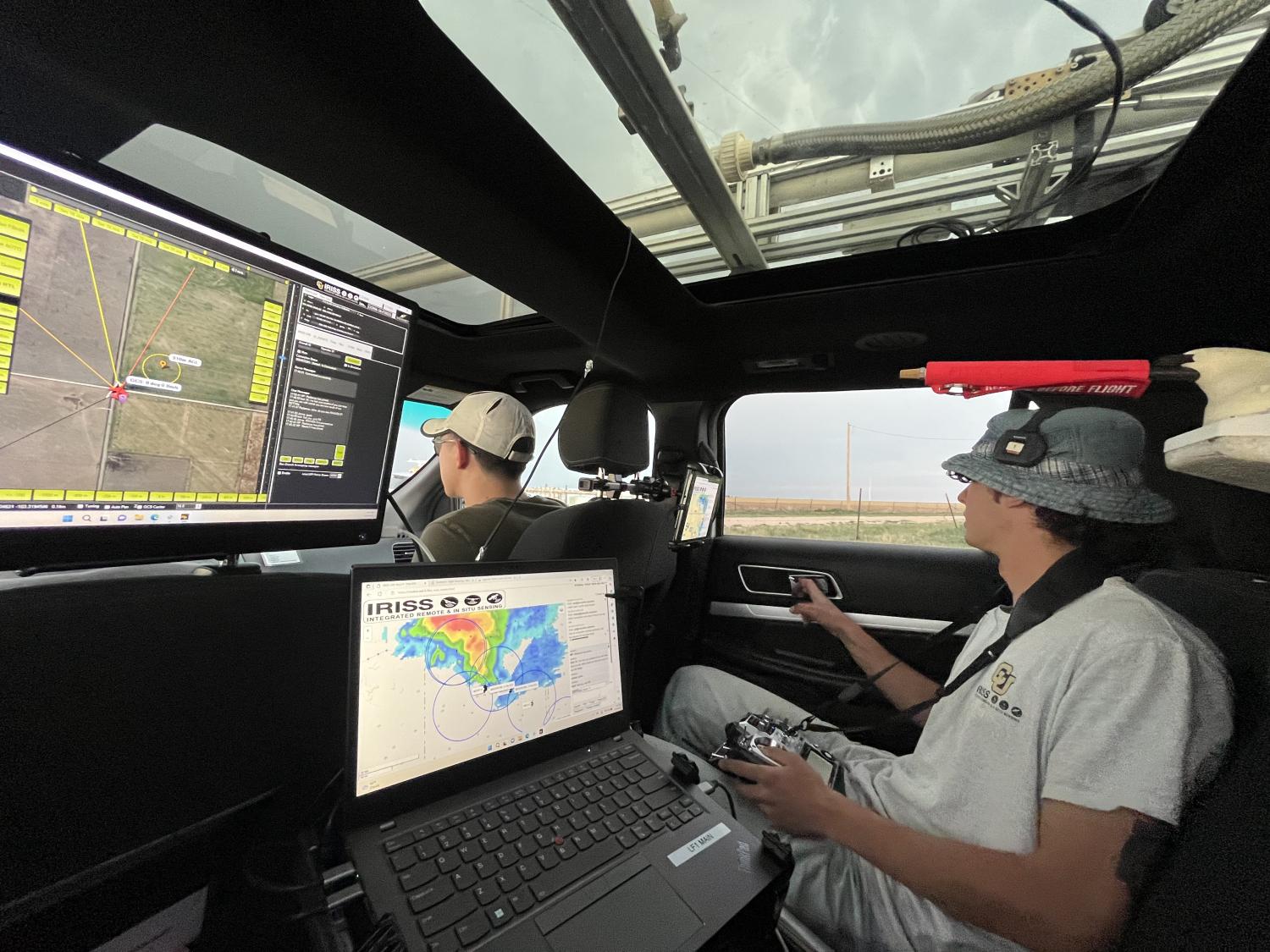
Céu Gómez-Faulk in a RECUV radar vehicle during a previous tornado campaign.
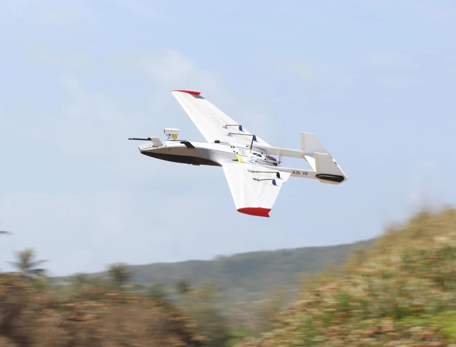
RAAVEN fixed-wing drone in flight.
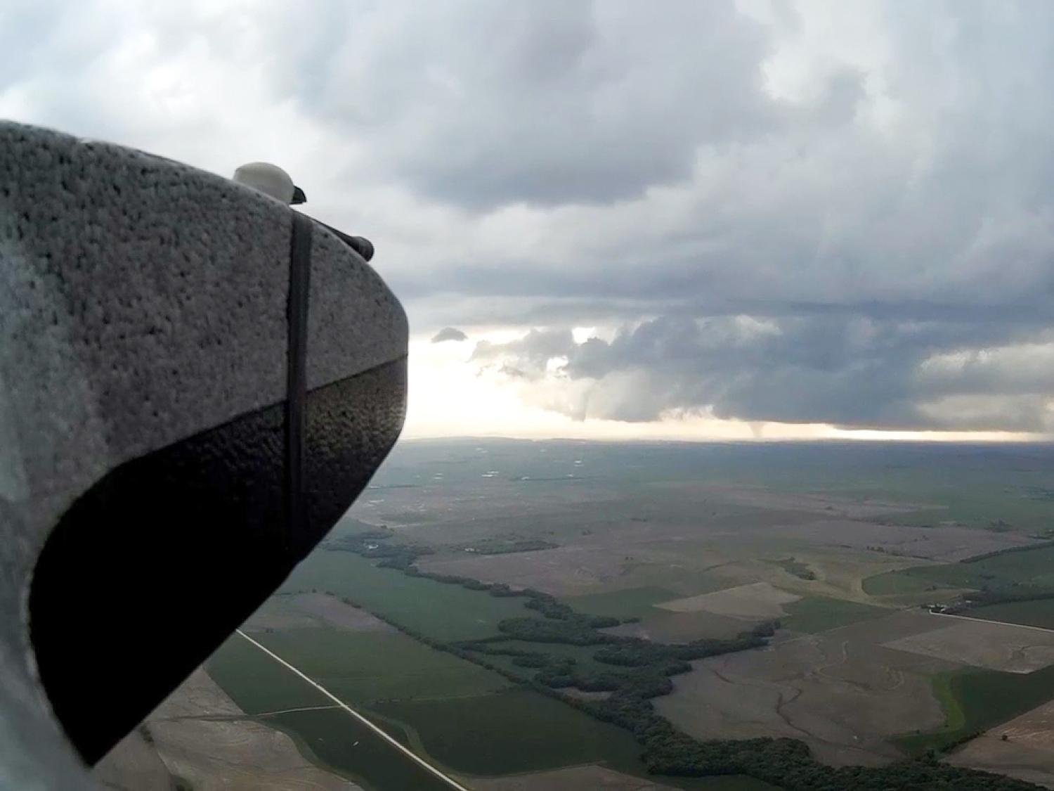
RAAVEN uncrewed aerial system in midflight.