
Podcast: AES Professor Frew on drone based storm research, airborne scientists and the movie "Twister"
In this episode, OnCue talks to Smead Aerospace Professor Eric Frew about CU Boulder's role in project TORUS. Project TORUS–or Targeted Observation by Radars and UAS of Supercells–is a two-year partnership between CU Boulder, the University of Nebraska-Lincoln (which is leading the work), Texas Tech University, the University of Oklahoma and the National Severe Storms Laboratory. The goal is to collect data to improve the conceptual model of supercell thunderstorms, the parent storms of the most destructive tornadoes, to help with future forecasting and warning.
Read more: CU Boulder deploys drones to get answers about tornado formation
[soundcloud width="100%" height="166" scrolling="no" frameborder="no" allow="autoplay" src="https://w.soundcloud.com/player/?url=https%3A//api.soundcloud.com/tracks/632759613%3Fsecret_token%3Ds-7zNpo&color=%23cbb476&auto_play=false&hide_related=false&show_comments=true&show_user=true&show_reposts=false&show_teaser=true"][/soundcloud]
Announcer: And now from the University of Colorado in Boulder the College of Engineering and Applied Science presents OnCUE.
Josh Rhoten: Welcome to this edition of OnCUE, my name is Josh Rhoten and I'm a communications specialist with the college. Spring and summer in the Rockies and Great Plains often bring thunderstorms that can be as beautiful as they are violent. The largest and least common of these storms are known as supercells. These are the storms that can produce baseball sized hail heavy rain and tornadoes and get plenty of coverage on the nightly news and internet video sites. While these stosrms occupy a large part of our national consciousness thanks to pop culture and folklore, experts still don't know why some super cells produce tornadoes and others don't. Engineers, scientists and meteorologists are working together to answer that question to reduce false alarms and provide more warning time to those in the path of destruction. The latest project in that effort is TORUS. It's one of the largest and most ambitious drone based investigations of meteorological phenomena ever. And it features researchers from the University of Nebraska Lincoln, Texas Tech University, the NOAA National Severe Storms Laboratory, and the University of Colorado Boulder through the College of Engineering and Applied Science. Researchers here join the project from May through June this year, deploying on many storms that produce tornadoes and gathering valuable data from the area via their custom Raven drones. For this edition of OnCUE I sat down with aerospace Professor Eric Frew after he and the team returned to Boulder. We talked about misconceptions from the movie "Twister," how the drones were built, and how this research could potentially save lives in the future.
Rhoten: Great. So tell me a little bit about the TORUS project. What does the acronym stand for and what's your goals with it?

Rhoten: Can you tell me why it's important to study these supercell thunderstorms. What's the goal or long-term range of plans for you guys?
Frew: So the long-term goal or the long-term motivation of the project is to improve the lead time in tornado warnings. So currently tornado warnings are issued when specific things are seen in the radar. When the storm is actually about to produce a tornado and the general public gets about 15 minutes of lead time if a tornado is going to form during that warning. The severe storms community believes that with better understanding of the storms we can push that to an hour so you can do a lot more to get safe if you have an extra 45 minutes of time. Before we can do that we need to understand what leads to tornado formation better and so the goal of the project is still that fundamental scientific understanding of tornado formation so that we can do better forecasting.
Rhoten: And using drones is not new for CU Boulder, you guys have been using this kind of technology before to study the same sorts of questions right?
Frew: So at CU Boulder we've been developing drones and using them for atmospheric science and related Earth Science Applications for probably two decades now. But we are doing some novel things in this project in particular we're flying multiple aircraft at the same time in new regions of the storm so without getting into a lot of meteorology supercell thunderstorms which are the storms that produce most tornadoes have some structure and the meteorologists talk about things like the left flank at the right flank of the storms. In the past we've flown in the right flank. It's the relatively calmer part of the storm if there's such a thing whereas this time we're flying in the left flank which is more into the heart of the storm and so that's a much more challenging environment than we've done in the past. The other novelty is we're flying up to three aircraft at the same time. In years past we flew one aircraft only so we were really focused on that one team whereas now we are coordinating multiple aircraft in different parts of the storm to really gain a much broader perspective on what's happening.
Rhoten: Can you put into context why you would want to use a fixed wing drone for this? What's the advantages of that?
Frew: So there's two parts to your question, the first is why a drone in the first place? So actually in something like the 1970's the severe storms community and something that was called Vortex One, I believe, flew piloted aircraft in and around these storms and they got really- they hit some very turbulent air and it was very dangerous and the community said that is not something that's safe. We don't want to do that in the future and so unmanned aircraft or drones are really the only type of aircraft that you want to put into this environment. There are certain variables that you cannot measure without touching the storm, radar and remote sensing gives a lot of information but you don't know the temperature and the humidity in the air unless you're there. So that's why we want to fly an aircraft in the environment, balloons don't go where you want them to. So an unmanned aircraft is the answer. Now we fly what's called a fixed wing unmanned aircraft it looks like a conventional aircraft just smaller because it has the endurance and the flight characteristics to really handle that type of conditions that were flying in. Our aircraft can fly for about three hours in ideal conditions in the storms, we fly for about 90 minutes. A multi-rotor drone would just be a more conventional picture maybe you can fly for 30 minutes in these types of conditions.
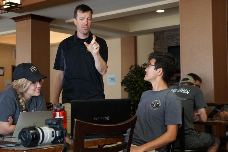
Rhoten: The CU team is made up of faculty, staff, students. Can you tell me what the composition is like?
Frew: Yeah so. So our team has several faculty like myself three staff engineers from the CU Grand Challenge IRISS initiative and then the rest are students either undergraduate students or graduate students. Several of our pilots who are actually in command of our aircraft are in fact students that have been trained here at CU to do this work. And a lot of the developments, a lot of the support, also comes from the students.
Rhoten: Is it good hands-on experience for them?
Frew: Oh it's fantastic hands on experience and one of the students said to me, 'this is the most fun I've ever had at CU.
Rhoten: When I first heard about the project I immediately thought of the movie Twister. But there's probably a lot of misconceptions or those kinds of ideas floating around can you talk about what maybe the biggest misconception is?
Frew: So we get that comparison a lot. And the biggest misconception is that we are not trying to fly into the tornado itself. The severe storm community has a pretty good understanding of what's going on in the tornado. Our goal is to understand what leads to the formation of the tornado. We're trying to study the storm in a much broader way. In fact we should not be closer than two miles to where a tornado would form. It's about the air that leads into the storm. What's happening to that and what becomes the tornado that we're studying.
Rhoten: What's a normal day look like for you when you actually get going?
Frew: The severe storm season in the U.S. and the Great Plains typically runs from at the beginning of May to mid-June. So we're on call during that entire time. If there aren't storms in the near future sometimes we'll stay at home and wait till weather conditions develop. So I'll really describe what happens while we're in the field itself and we'll chase weather you know day to day as it goes. A typical day will begin around 10 a.m. we'll have a weather briefing with the entire TORUS team that's obviously led by the meteorologists, the CU Boulder team we're the the flight support team so we don't really have a lot to contribute to those discussions although the FAA limitations of where we can operate certainly play into those decisions. So that's about an hour, we discuss the weather conditions for the day we discuss where we think we need to be. And we also look ahead to the next day, so in the meteorology world today is called day one, tomorrow is called day two. So at the end of the day today no matter what we do we need to start positioning ourselves for what we're going to do tomorrow as well. Once the briefing is over we typically have anywhere from two to six hours of driving to get in position. We're very nimble as an armada, you go where the weather takes you. You don't just sit there and wait for it. So we'll leave eleven, twelve o'clock. We'll drive till 4, 5, 6, – 7 o'clock, sometimes these types of storms that we're interested in studying sometimes will not form until 7 p.m.
Rhoten: Right, it's a lot of hurry up and wait. Right?
Frew: We call it hurry up and wait because you really want to position yourselves and then you see what the weather's doing and then you wait until you have a good sense and then you rush to the next stop. Yeah.
Rhoten: Is there times where it's wait five minutes is there time where it's wait five hours you don't know?
Frew: Usually I'd say it's wait an hour if you're waiting five minutes that's usually just to swap a piece of equipment or for the team to catch up.
Rhoten: What is it like when you're out there trying to deploy a drone and the tornadoes forming and what's that excitement like?
Frew: So as we prepared for this mission we had a discussion with our meteorologists and they kind of laid out for us the main risk factors to be involved in in fact the tornado is not even in the top three. So when we're thinking about being out there the thing we worry about the most are other drivers. So in these storms you get a lot of tornado chasers and so they call it chaser convergence and that's the number one thing we look out for. The next two hazards are lightning and then hail and then the last one is the tornado. So when we're getting ready to deploy the first thing we're worrying about is the other cars and the other drivers and making sure we find a safe spot kind of off the road. Then it's mostly the lightning that you kind of worry about. And I'd say only once when we were deploying did I feel like there was lightning even nearby. I mean it's not a major hazard but it's the thing that I'm watching out for as we're getting set up. Otherwise we're with professional meteorologists they know these storms we're always on the outside on the edges we're not in heavy precipitation so there's some adrenaline because we're about to go but we're always safe and so and we've been doing this for a long time that we're professional about it. And so we know what our roles are and we just move forward and we get in the air and we continue with the mission.
Rhoten: Tell me about chaser convergence and having so many people there. Has that ever prevented you guys from deploying?
Frew: Chaser convergence I think it's the term that the meteorologist used to indicate that the roads can become clogged with storm chasers. We've seen this happen a couple of times this past year in our deployment it just traffic backs up. It's also dangerous because most of the people in that traffic are trying to see the storms take pictures they quickly pull off to the side of the road. So it is something that slows us down. We we were not prohibited from our operations because of that phenomenon. It's just something that slowed down our ability to operate and something we had to pay extra attention to.
Rhoten: Well the data set is an interesting aspect too because you were telling me that you don't necessarily want to get all tornadoes all the time.
Frew: Yeah. So the scientific question is what conditions in these super cell thunderstorms lead to tornadoes? And so maybe backing up a step, I'm making up the numbers but the round averages are about the same. Something like ninety five-ish percent of all tornadoes come from a supercell thunderstorm – a very specific type of storm – but only single digit percentages of super cells create tornadoes. So there's still a lot that's not known about the formation process. And so in order to understand what about this storm is leading to a tornado you need to have a lot of data where that does happen and a lot of data where that doesn't happen so you can see what's different. So that's why ideally you know half of our data will be storms that produce tornadoes. Half of our data will be storms that don't. So we can kind of compare and contrast between those two sets of data.
Rhoten: When you're working on a project this large and collaborating with other universities is there any other trickiness collaboration problems that you encounter?
Frew: So our team here to CU Boulder has been working with some of these severe storm scientists for two decades. So we've really developed a relationship and we understand each other's equipment and we understand how the deployments work. Something that's really neat about this large of a project is I think of it as a federation or like each team sort of knows the big picture knows how they operate. There's a leader on a day to day basis who identifies which storm we're going to operate on. And then we all know how to do our things separately. With this type of a storm we've introduced something called the pivot instrument which is that one instrument that everyone's going to use to coordinate their activities. Because the unmanned aircraft because the drones are the novelty and the new science is going to come from them. That left flank mission that I mentioned earlier is the pivot instrument. So the chief meteorologist and the lead investigator for this entire project is the one that's directing that aircraft. And he's letting the entire team know the plan the schedule the timing of when that aircraft is going to be in the air and every other sensor is positioning in itself in its own way, knowing when that aircraft is going to fly. And so that's sort of we think of this as a loose coordination. You know we're not all on the phone or on the radio on the minute to minute basis but everybody knows that that aircraft is planning to take off in 30 minutes so you need to be in position in 15. So you're capturing the volume of air where it will be operating. And so that's how we stay coordinated and again these groups have been working together for decades. So we understand each other's limitations how we have to operate. And so it's been a very easy collaboration with this team.
Rhoten: Can you broadly to see what the other tools that are being used are in the team? I know there's an airplane.
Frew: Yeah. So I've mentioned before various different institutions that are participating and they sort of bring their own different pieces of equipment. I'll start with the University of Nebraska at Lincoln, they are the lead university Adam Houston from UNL is the lead meteorologist for this project. They also have what are called mobile mezzenet vehicles. These are ground vehicles Ford Explorers with weather measuring equipment sort of on a pole coming up from their roofs so they get what we call surface observations. They're figuring out what's the pressure, temperature, humidity, wind on the ground the exact same things the drones are measuring. And so then we have the CU Boulder team. We're flying drones in the storm. We coordinate very closely with the UNL team in fact pretty much. There is one of the UNL's mezzenets underneath the drone where it's flying. So we have two measurements in the environment to kind of compare to the surface and in the sky. Texas Tech has whats called a Ka band radar. In fact they have two radar so they do what's called dual Doppler measurements so with two radar you can actually resolve three dimensional structure of the winds that are in the storm. You also get what's called reflectivity which tells you something about the strength of the precipitation if there's rain if there's hail in the environment. We then have colleagues at the University of Oklahoma and the National Severe Storms Lab they have additional mobile mezzenets. They released balloons soundings sort of well back from the storm to to understand the kind of precursor conditions to these storms. That's also very helpful for understanding and then the last piece of equipment is something that the National Severe Storms Lab brings. This is the P3 Orion Hurricane Hunter aircraft. So this is a piloted aircraft it's the hurricane hunters the same aircraft that go into hurricanes to study them. They're flying on these storms with us. They have radar so they aren't flying in the heart of the storm like the drone is but they're able to get out and get this picture from above the storm of what's going on. All that data together is needed to understand what's happening not just any one of those.
Rhoten: Can you see a world where there's more equipment being involved for CU particularly so, more drones or is there another aspect that you would like to include in this in 15 years when something else happens?
Frew: That's a great question and maybe there's two parts to it. You know I'm an aerospace engineer so for me it's the drones. My vision is that while these drones are flying they're actually talking to the weather models and they're using the model to make decisions in real time on where to go to best understand this storm. Imagine the drone has sort of in its mind a forecast has two forecasts and it knows that if I get cold here the forecast that says tornado is more likely if I get hot here the one that says no tornado is most likely. So that's my vision for where this idea can take us.
Rhoten: That'd be really cool.
Frew: I think it'll be very exciting to see this airborne scientist concept, right now that the TORUS project is a unique deployment all these assets don't exist in every town in the Great Plains. So the other aspect of your question is we could see in the future the drone technology advancing to the point where small towns individuals have drones that they could release into these environments or into the precursor environments to help feed into the weather system much like you know citizen science works now with weather stations on your your roof or your house or whatnot. So I think there could be a time in the future where you know local meteorologists, local first responders, local public safety officers also have related technologies that provide just a little bit of additional insight to their local towns to help provide some additional safety.
Rhoten: Great. Well thank you very much for talking to me it's an interesting project for sure.
Frew: My pleasure.
Announcer: This has been OnCUE for more information visit Colorado.edu/engineering.