
Chasing hail: Researchers fly drones into storms as part of largest US hail study in 40 years
CU Boulder researchers follow a storm brewing in south central Kansas. (Credit: Patrick Campbell/CU Boulder)
Gray clouds swirl above a dusty highway in eastern Colorado between the towns of Akron and Atwood—what’s left of a thunderstorm that rolled through this stretch of prairie and rangeland just minutes before.
Wind whistles through patches of stubbly grass nearby. Then a hiss and a pop break the silence. A group of researchers release a blast of compressed air to fling a flying drone from a metal scaffold, or “catapult,” sitting on top of a white SUV. The uncrewed aircraft system (UAS) measures more than 6 feet from wingtip to wingtip. It catches the wind, and its rear propeller buzzes to life, lifting the plane dozens of feet into the air in a matter of seconds.
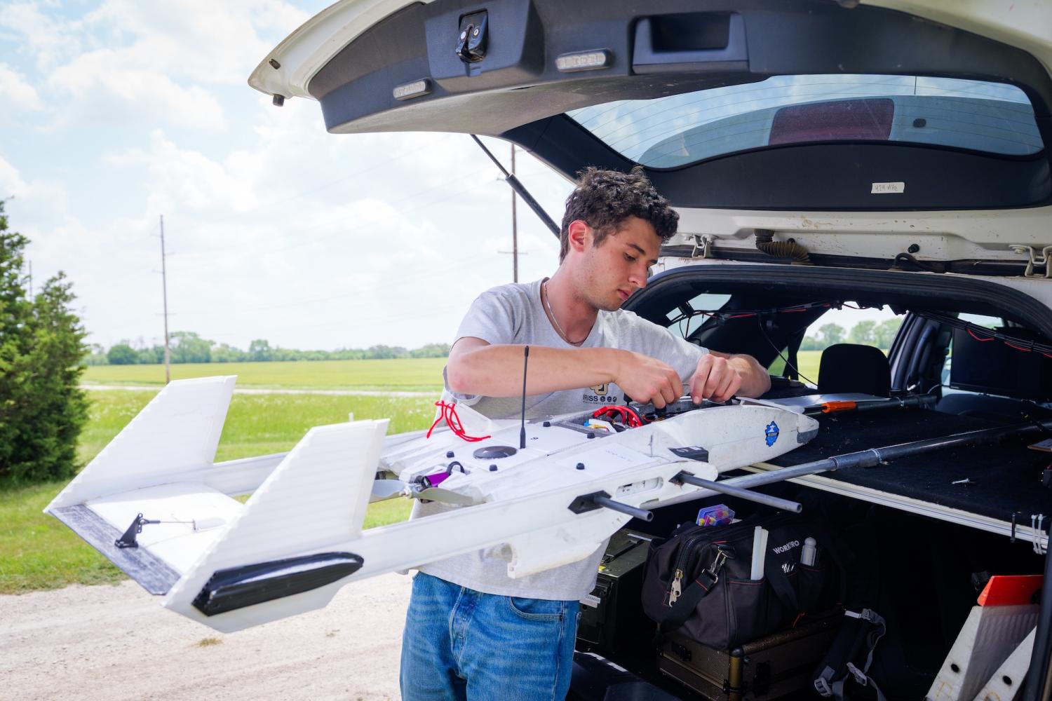
Céu Gómez-Faulk makes adjustments to the RAAVEN drone. (Credit: Patrick Campbell/CU Boulder)
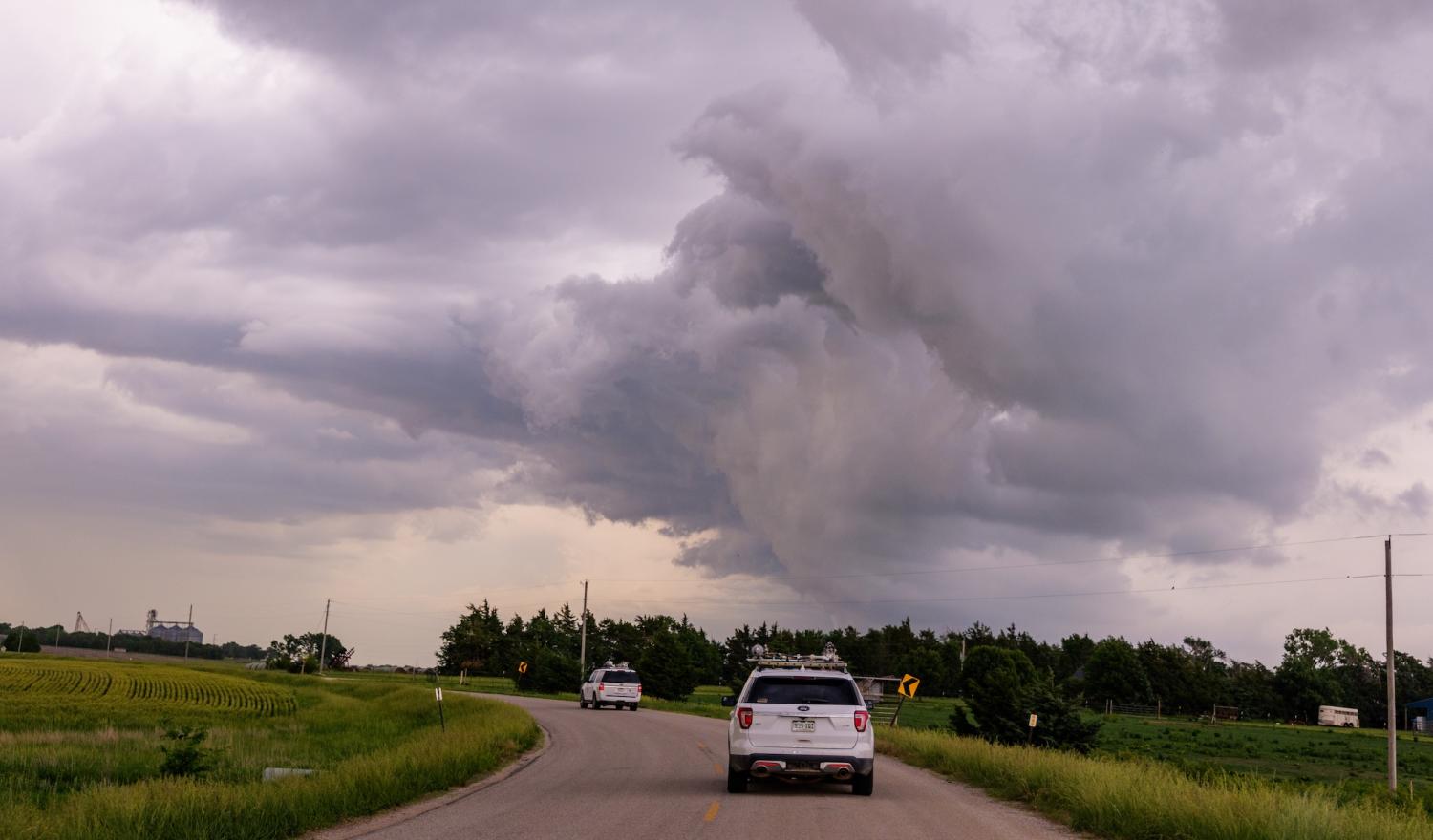
The IRISS team rides out an oncoming storm near Wichita, Kansas. (Patrick Campbell/CU Boulder)
The chase is on.
Aerospace engineering sciences Professor Brian Argrow and his team at the University of Colorado Boulder have joined a research project called the In-situ Collaborative Experiment for the Collection of Hail In the Plains, or ICECHIP. For six weeks this summer, scientists from 15 U.S. research institutions and three overseas are criss-crossing the country from Colorado east to Iowa and from Texas to North Dakota.
They’re searching for summer thunderstorms.
The group is exploring the conditions that give rise to hail in this part of the country—peaking in the summer and causing billions of dollars of damage every year. In the United States, hail is most common in Colorado, Nebraska, Wyoming and nearby regions, which are sometimes dubbed “hail alley.” Today, ice the size of grapes and even bigger litter the side of Colorado’s State Highway 63.
The campaign is led by Rebecca Adams-Selin at the company Atmospheric and Environmental Research and is funded by the U.S. National Science Foundation. It’s the largest effort to study hail in the United States in 40 years.
The researchers hope to understand not just how ice forms miles above the ground, but also how homeowners and builders can protect their properties from dangerous weather. They’ll do that by using radar to peer inside hailstorms. They’ll collect and freeze hailstones, and they’ll crush hail in vice-like devices to see how strong it is. Argrow’s team is usings its drone to map the swaths of hail that storms leave behind them in their wake.
“It is about saving lives and saving property,” said Argrow, professor in the Ann and H.J. Smead Department of Aerospace Engineering Sciences and director of the Integrated Remote and In-Situ Sensing (IRISS) research center at CU Boulder. “We’re working with meteorologists and atmospheric scientists trying to increase warning times to give people a chance to get to safety and work with engineers and insurance companies to build better infrastructure to withstand these onslaughts.”
His team pilots the plane, known as the RAAVEN, short for Robust Autonomous Airborne Vehicle - Endurant and Nimble, north toward the rear flank of the thunderstorm. Then, they jump into two SUVs and follow the drone as it flies as low as 120 feet above them. A camera in the plane’s belly captures the ice trailing behind the storm. From that vantage point, the landscape, normally brown dotted with green, now also has pearly white patches for hundreds of yards in either direction.
For Céu Gómez-Faulk, who’s piloting the drone today, the sight is a testament to thunderstorms.
“It’s awe-inspiring in a very serious sort of way,” said Gómez-Faulk, a graduate student in aerospace engineering sciences.
Credit: College of Engineering and Applied Science
Dark skies
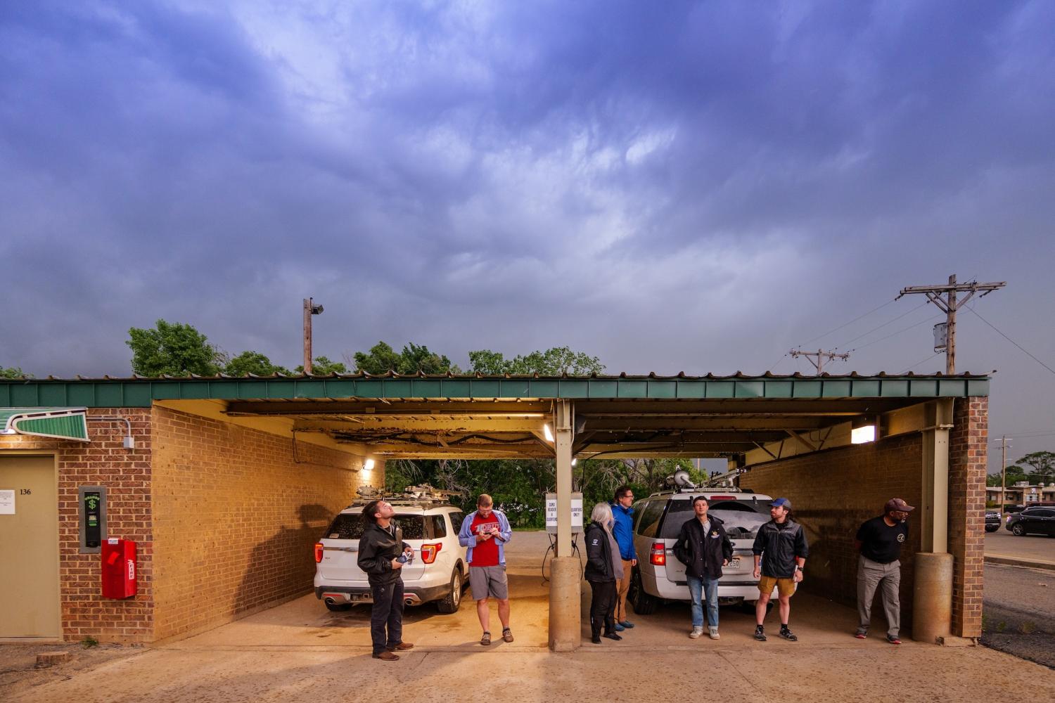
Five days earlier, Argrow and his team from CU Boulder join the ICECHIP armada at a Phillips 66 gas station in Greensburg, Kansas. The crew includes three graduate students, two IRISS employees and Eric Frew, professor of aerospace engineering sciences. They’re marking the first day of the project’s field season, or what the researchers call Intensive Observation Period 1 (IOP 1).
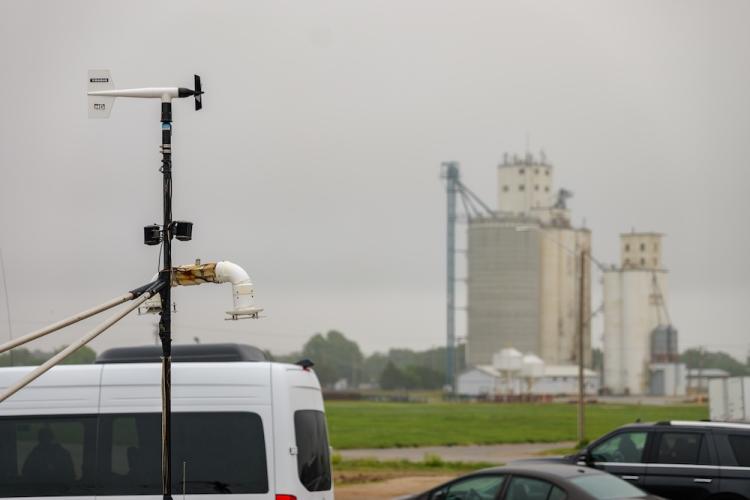
Judging by the conditions, the team should have plenty to study today. Weathervanes sitting on top of vans whip in circles as gusts blow a misty rain through Greensburg, a town in south central Kansas that is home to just over 700 people.
What makes hail
When conditions are right in states like Kansas and Colorado, winds blowing over the prairie can start to lift upward, forming a powerful column of rising air. These updrafts can push clouds from the lowest layer of the atmosphere, the troposphere, up to the colder stratosphere, which begins miles above Earth’s surface.
Within those towering, cauliflower-like clouds, tiny drops of water may freeze, then bounce around in the air—a sort of atmospheric game of Plinko.
That’s how hail is born.
“It starts with what we call a hail embryo, or ice,” said Katja Friedrich, professor in the Department of Atmospheric and Oceanic Sciences at CU Boulder. “It goes through the cloud, and it accumulates supercooled liquid, which is liquid that is below freezing. The embryos accumulate more and more until they fall.”
But there’s still a lot that scientists don’t know about what happens inside the clouds.
To help find out, Friedrich is participating in the ICECHIP campaign through an effort that’s separate from Argrow’s team and its drone. Over the summer, two researchers in her lab, Jack Whiting and Brady Herron, are traveling with the armada in a red pickup truck. They’re using a device called a microwave radiometer to collect measurements of the air that rushes into hailstorms from outside—exploring how environmental conditions can feed a storm to keep it churning, or even cause it to die off.
“It’s my dream to be doing this, to be in the field studying severe weather,” said Whiting, who graduated from CU Boulder with a bachelor’s degree in atmospheric and oceanic sciences in spring 2025. “There’s a good chance that these events are going to become more frequent in the future because of climate change, so it’s really important to understand these dangerous storms.”
“This is relatively typical this time of the year, mid-May for the Great Plains. That’s when the storms really turn up and pass through,” Argrow said. “If you live in this area, you know what this means.”
In Greensburg, they definitely do.
In 2007, a tornado ripped through the heart of this community, damaging or destroying more than 1,400 homes and buildings and killing 10 people. Just hours after the ICECHIP crew departed on May 18 this spring, another tornado touched down south of Greensburg. It traveled 11 miles before dying out, and no injuries were reported.
Argrow is no stranger to the danger storms bring. He grew up in Stroud, Oklahoma, in the heart of Tornado Alley and remembers sheltering in his family’s storm cellar during severe weather warnings.
The engineer and his colleagues previously worked on a project, led by long-time collaborator. Adam Houston of the University of Nebraska-Lincoln, called Targeted Observation by Radar and UAS of Supercells (TORUS). Over two seasons, the group flew RAAVEN aircraft into supercell thunderstorms, the phenomena that give rise to dangerous tornadoes.
But while storm-chasers may pay a lot of attention to those kinds of weather events, hail causes more damage than tornadoes every year, said Ian Giammanco. He’s the lead research meteorologist for the Insurance Institute for Business & Home Safety (IBHS), a non-profit organization supported by property insurance and reinsurance companies.
Since 2012, hail has caused an estimated $280 billion worth of damage in the United States, according to IBHS estimates. The largest piece of hail ever discovered was about 8 inches wide, the size of a large cantaloupe.
“Our role is to understand how we can design better building materials to withstand hail,” said Giammanco, whose team is joining the ICECHIP expedition on the road. “Whether it’s a lot of small hail, or these really big hailstones, we want to understand what that risk looks like.”
Ellington Smith, a graduate student on Argrow’s team, was an undergrad at Iowa State University in spring 2023 when hailstorms erupted around the state, flattening corn fields.
“Knowing what hail can do to farmland, its’ really important to be able to quantify the damage—figuring out why these hailstorms happen and how to better predict them,” Smith said.
Intrepid aircraft
Adams-Selin and the ICECHIP team are taking what she calls a “holistic” approach to studying those kinds of dangers.
The study armada is something to behold: At the start of the field season, the ICECHIP campaign included around 100 researchers traveling in more than 20 vehicles—including pickup trucks with mesh canopies overhead to protect them from hail damage and two Doppler on Wheels trucks. These massive vehicles carry portable, swiveling radar dishes that can peer into the heart of hailstorms.
“ICECHIP is 100% NSF funded,” Adams-Selin said. “If you want to know who is responsible for improved hail forecasts, better understanding of hail science and any of these technological advances that we are using, like mobile radar, that is all NSF funding.”
The IRISS team depends on a vehicle that is a little smaller—the RAAVEN.
It’s a tough little drone. The aircraft is based off a kit designed by the company Ritewing RC. This same design inspired a storm-chasing drone that appeared in the 2024 summer blockbuster Twisters. The body of the RAAVEN is made from the same kind of foam that’s in your car bumper. It also carries sensors for measuring wind speeds and air pressure, temperature and humidity.
If the RAAVEN is flying with the wind, it can hit speeds of 75 miles per hour or more, and the aircraft can fly for up to two hours uninterrupted.
“Radar can only tell you so much,” said Frew, who joins Argrow on the ICECHIP campaign. “To really further our understanding of the atmosphere, you have to be in it.”
For ICECHIP, the team also added a 360-degree camera that drops out of the belly of the RAAVEN after it launches.
The IRISS team’s key role on the ICECHIP campaign is to measure the swaths of hail that storms leave in their wake.
A storm builds near Greensburg, Kansas. (Credit: Patrick Campbell/CU Boulder)
The team doesn’t fly the RAAVEN directly into storms for ICECHIP. Instead, it stays safely behind the bad weather, soaring in a zig-zag pattern in the wake of hailstorms as they billow across the landscape. Using the drone’s camera in real-time, the researchers view the area below that’s covered in ice. They can then measure the width of these hail swaths, capturing how big a storm’s path of destruction can grow. Argrow likens it to “a snail that leaves a trail.”
Federal Aviation Administration rules require Argrow’s team to stay in sight of the RAAVEN at all times. To do that, the researchers get in their SUVs.
Gómez-Faulk explained that the RAAVEN is semi-autonomous. Pilots like him can control where the aircraft goes, but it’s also programed to follow a sort of digital marker the team refers to as a “carrot.”
“There’s a carrot guide point that we set off some distance from the car, usually in front of the car,” he said. “The aircraft is going to chase that guide point as we drive.”
Heart pounding
Back in Greensburg, Frew emphasizes that safety is the number one priority of the IRISS team. But he acknowledges that central Kansas at the height of storm season may be an odd place to find an aerospace engineer.
Before Frew started working on projects like TORUS and ICECHIP, he didn’t know a lot about weather. His time on these studies, however, has taught him to respect the power of storms—and what engineers can accomplish when they bring their work out of the lab and into the real, windy world.
“The first time I did it, my heart was pounding. I didn’t know what to expect,” Frew said. “In order to understand this environment, someone has to go into it and take the measurements, and that’s what we’re here for.”
IRISS snapshots from the road
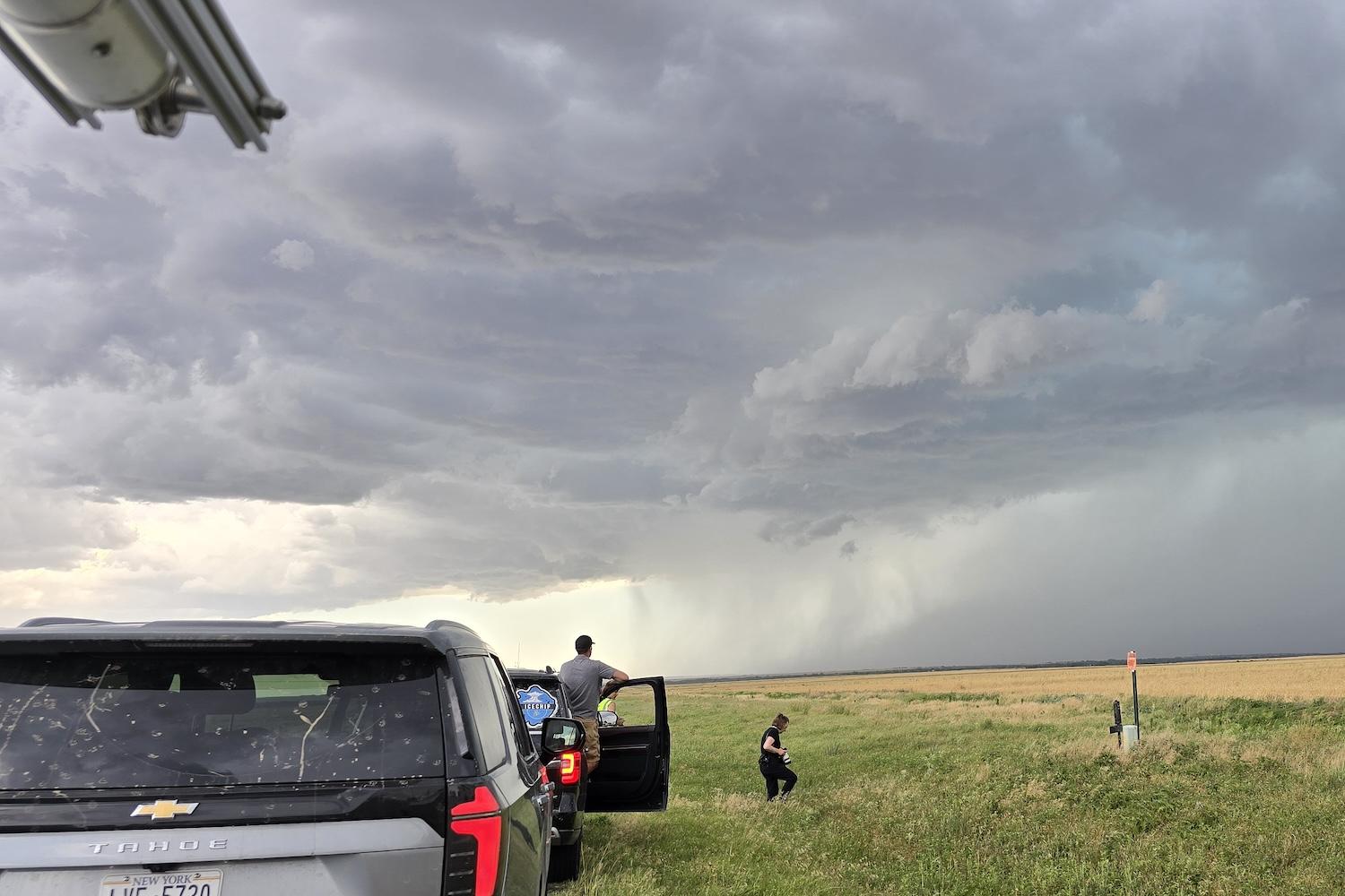
Tracking a storm near Wichita Falls, Texas

Taking a break in Tucumcari, New Mexico
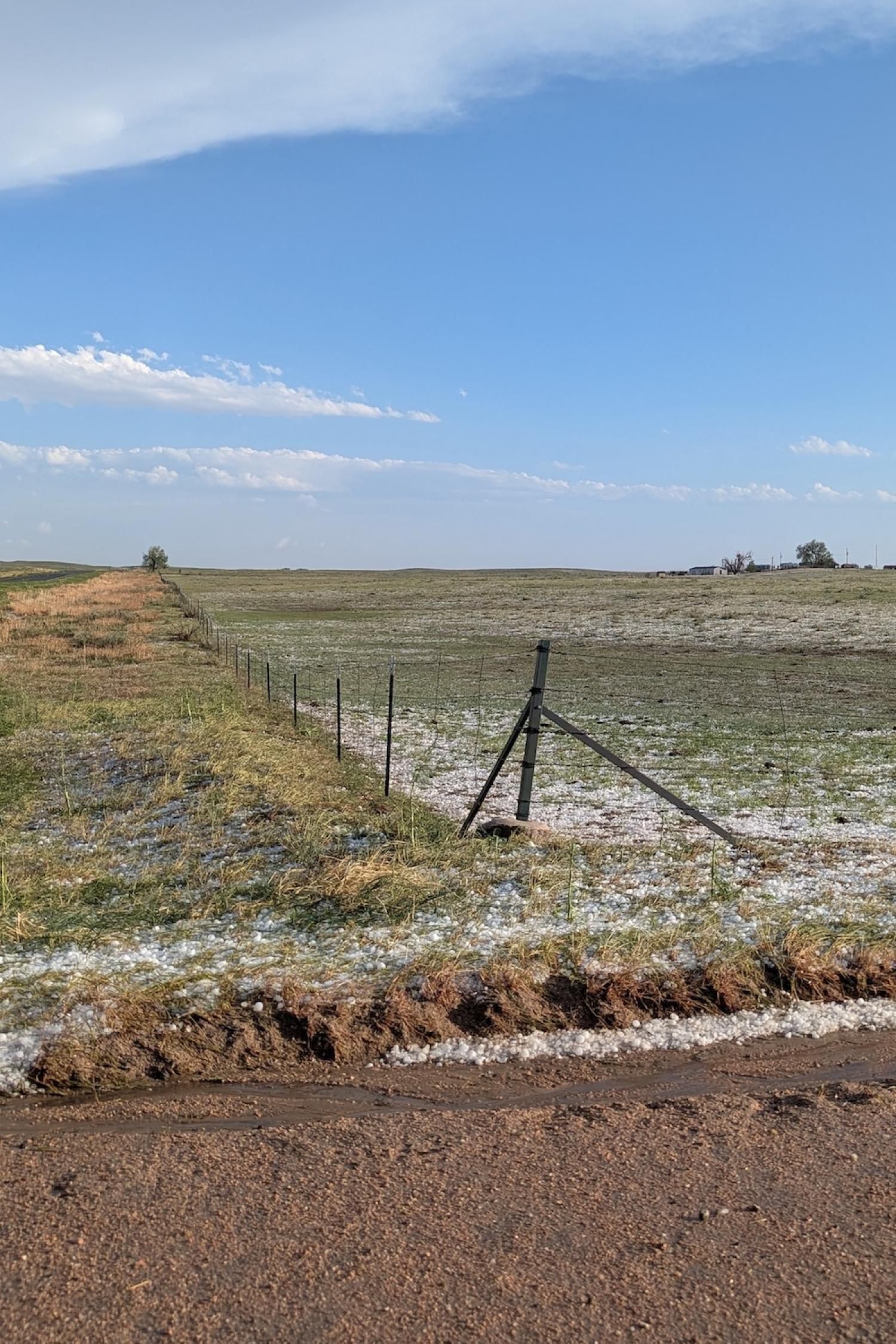
Seeing hail in northeast Colorado
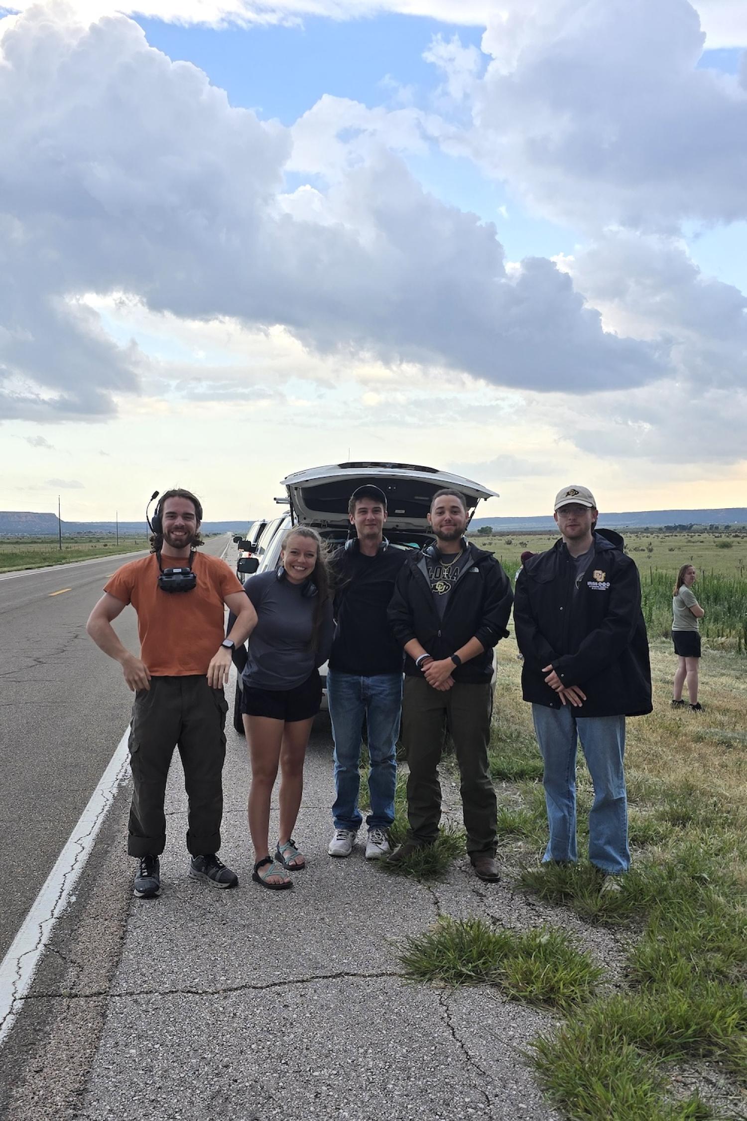
Posing for a photo in eastern New Mexico
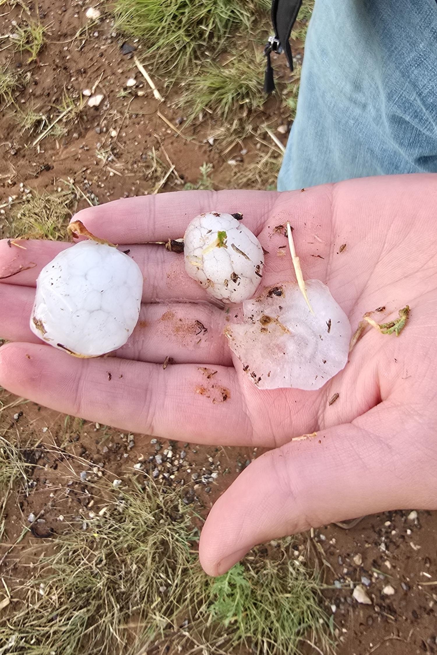
Finding hail near Morton, Texas