As rising temperatures affect Alaskan rivers, effects ripple through Indigenous communities
Banner image: Small rivers draining the Brooks Range in Gates of the Arctic National Park, Alaska. (Credit: Josh Koch)
Streamflow is increasing in Alaskan rivers during both spring and fall seasons, primarily due to increasing air temperatures over the past 60 years, according to new CU Boulder-led research.
This increased volume of free-flowing water during the shoulder seasons is compounded by earlier snowmelt and thawing permafrost, also driven by increasing temperatures; all of which are affecting the formation and safety of Alaska river ice in winter, and the timing of when rivers “break up” in response to seasonal warming each spring.
The findings are the result of a collaboration between researchers at CU Boulder, the United States Geological Survey (USGS) and the National Park Service, who analyzed data from 1960 to 2019 for nine major river basins in Alaska. Their results, published in February in Environmental Research Letters, show how rivers can serve as a measurable quantity for understanding the cumulative impacts of climate change in Arctic regions.
“Measuring rivers is useful because it integrates all these other changes in temperature, precipitation, permafrost and snow cover. All the dynamics that feed the hydrologic cycle eventually get filtered into the amount of water in a river,” said Dylan Blaskey, lead author on the study and doctoral student in civil engineering.


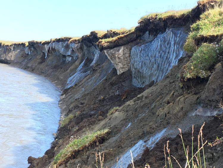
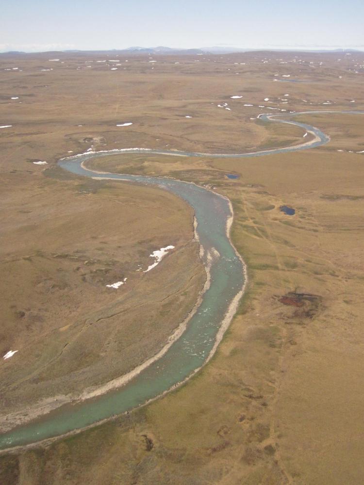
Top: Ice-rich permafrost bluffs on the bank of the Canning River, Alaska. (Credit: Josh Koch) Bottom: The Kuparuk River in Alaska. (Credit: Michael Gooseff)
This scientific work quantifies the consequences already observed and experienced for generations by local Indigenous communities who rely on these rivers for their livelihoods. They face not only cultural and financial losses from less dependable winter river ice but heightened danger when using these rivers for transportation and fishing.
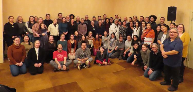
Ahead of the study’s publication, the CU-led research group hosted the Arctic Rivers Summit in Anchorage late last year. The gathering of Indigenous leaders and community representatives, government officials and scientists met to discuss these and other pressing issues facing Alaska and other Arctic communities. At the Summit, the team learned more about regional and local concerns and observations. The outcome is intended to help the researchers tailor and improve the delivery of scientific data to create information and products that are usable for Indigenous communities faced with planning for an uncertain future.
“We're using these river gages to monitor these remote areas, but there are many people who have a much more intimate and holistic knowledge of the landscape and how it's changing,” said Blaskey. “At the Summit, it became clear that we were converging on an understanding of how climate change is affecting Indigenous communities and Arctic ecosystems.”
Strides in streamflow
River gages are small pieces of equipment that monitor a river’s stream flow by measuring the amount of water that passes over it in a set period of time, usually each second. In comparison to the Lower 48, there are very few river gages in Alaska, said CU Boulder co-author Keith Musselman, assistant professor at the Institute of Arctic and Alpine Research (INSTAAR) at CU Boulder.
The researchers analyzed six decades’ worth of monthly data from river gages in nine Alaskan rivers, comparing streamflow to air temperature, soil temperature, soil moisture and precipitation across the basins. They also accounted for large scale climate anomalies, such as El Niño and La Niña.
Streamflow in Alaskan rivers typically peaks in summer, and remains quite low in winter, with stark transitions between the two seasons. The study found that while the amount of water flowing through these rivers on a yearly basis is not changing, when it flows through them is shifting, with more water freely flowing from October through April—creating more gradual seasonal transitions.
Changes in air temperature have had the biggest impact on streamflow in these Alaskan rivers. The average days above freezing in April and October have increased by about a day every decade, according to Blaskey. These months are also when average monthly streamflow has increased the most: by 15% per decade in April and 7% per decade in October.
They also found that the correlation of increased streamflow with temperature is only getting stronger over time when data from the first 30 years (1960–1989) are compared to the most recent 30-year period (1990–2019).
Since the 1960s, winter air temperatures have increased by 7.2 degrees Fahrenheit (4 degrees Celsius) on average across the global Arctic. The findings from Alaskan river gages help quantify the disproportionate impacts that climate change is having on the planet’s northernmost ecosystems.
“One of the opportunities and challenges of researching in Alaska is that signals of climate change have already begun to appear,” said Blaskey.
Ripple effects in community
Indigenous communities use rivers for vital transportation and sustenance, whether frozen in ice or as free-flowing water. Many rivers are part of traditional hunting and fishing routes, which can be traveled over when they are frozen. Rivers also serve as essential thoroughfares to connect communities and to bring in seasonal supplies, such as fuel and food, because road networks are limited in Alaska.
As the seasons shift, ice freezes later and breaks up earlier, undermining the stability and safety of river ice.
“The shrinking of the fall and spring seasons affects how long river ice persists and is safe to travel over. Indigenous communities have suffered an increasing number of fatalities over the last few decades,” said Musselman. “It seemed that everyone at the workshop had stories of someone who had fallen in the ice and lost their life.”
These and other timely concerns were shared at the Arctic Rivers Summit in December. Hosting this meeting was also another chance for Blaskey and his fellow researchers to listen to the communities most affected by the changes they’re studying, in addition to regularly working with an Indigenous advisory council who has helped guide their work since the inception of the project.
“Documenting the long-term changes in streamflow is a way for us to quantify and share what's happening in the rivers,” said Blaskey. “Indigenous communities already know what’s happening to the rivers.”
Together, Indigenous knowledge and long-term monitoring can help to develop narratives of change across the Arctic landscape to support planning and community adaptation, said Musselman.
Additional authors on this publication include: Joshua Koch, United States Geological Survey; Michael Gooseff, University of Colorado Boulder; Andrew Newman and Yifan Cheng, National Center for Atmospheric Research; and Jonathan O’Donnell, National Park Service, Arctic Network. This study is based upon work supported by the National Science Foundation’s Navigating the New Arctic program.


