
TIP SHEET: Hurricane Harvey
CU Boulder sources are available to discuss Texas and Louisiana flooding following Hurricane Harvey and other aspects of post-disaster recovery and possible impacts on the Gulf Coast.
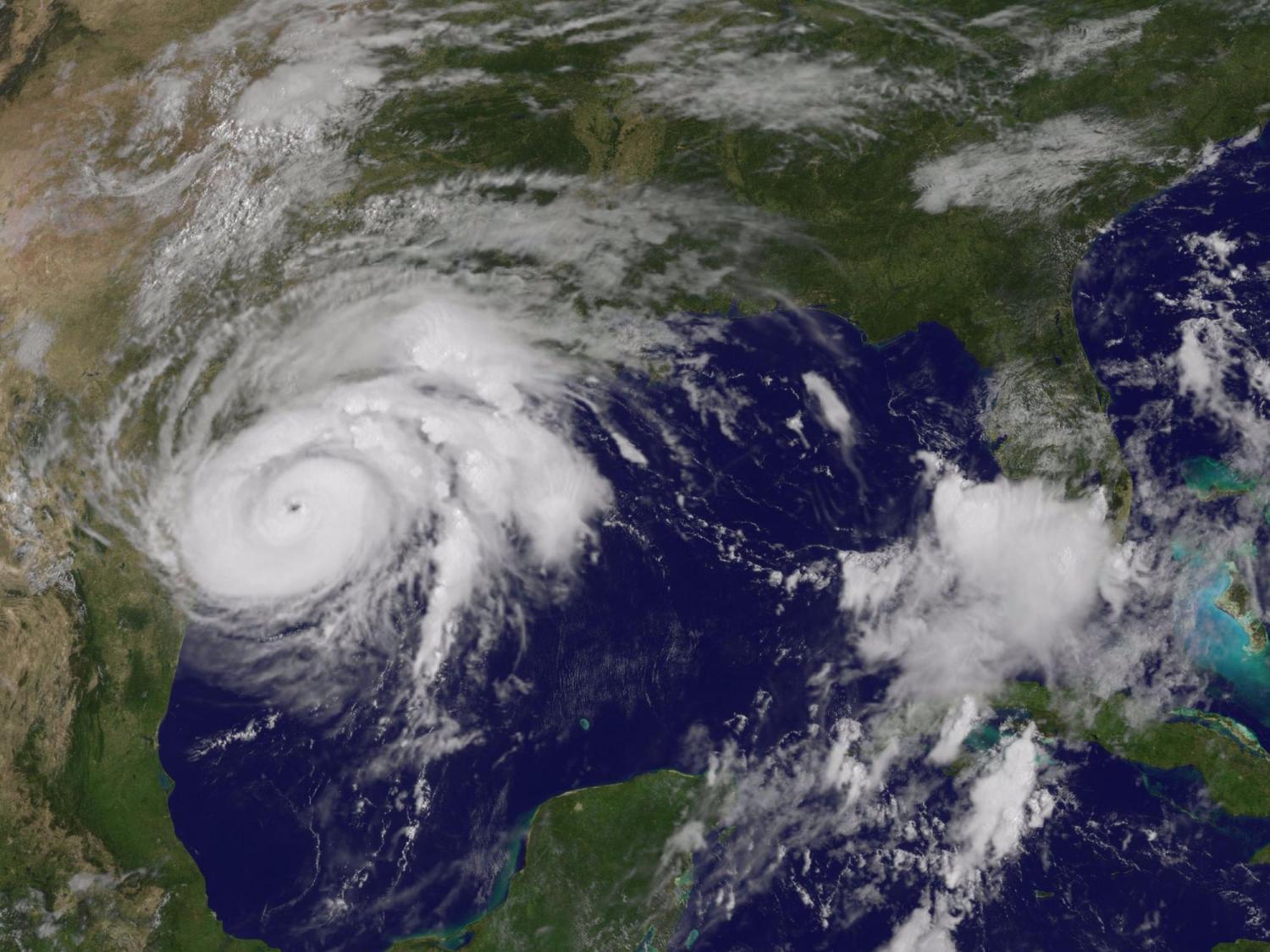

Click images to enlarge.
Robert Brakenridge, a senior research scientist and director of CU Boulder’s Dartmouth Flood Observatory, is mapping flooding in Texas and Louisiana in the wake of Hurricane Harvey in near-real time using satellite data. Observatory researchers use orbital remote sensing to detect, measure and map river discharge and river flooding. Flooding is monitored by NASA’s MODIS instruments and other space agency sensors as it occurs, then preserved as a record for future flood hazard evaluation.
The goal, Brakenridge says, is to acquire and preserve a digital map record of Earth’s changing surface water related to floods, droughts, wetlands shorelines, lakes and reservoirs for research and for public use, including humanitarian purposes. He may be reached at robert.brakenridge@colorado.edu or 303-735-5485.
The Observatory is part of the Community Surface Dynamics Modeling System at CU Boulder’s Institute of Arctic and Alpine Research.
Lori Peek, director of CU Boulder’s Natural Hazards Center and a professor in the Department of Sociology, studies vulnerable populations in disaster-stricken regions as well as post-disaster recovery. She is the co-author of the award-winning book Children of Katrina and is currently co-leading a National Science Foundation-funded workshop series on methods of interdisciplinary disaster research. She may be reached at lori.peek@colorado.edu or on her cell phone at 303-324-4132.
For further assistance, contact Trent Knoss at 303-735-0528 or trent.knoss@colorado.edu or Jim Scott at jim.scott@colorado.edu or 303-492-3114, both with CU Boulder media relations.