
Amino Acid Geochronology Lab
We address the timing of Quaternary events using a relative dating technique that has a temporal range greater than that of some common absolute dating techniques. Originally, many of the sample types analyzed in the lab were mollusks, but now include bird eggshells, algal remains, synthetic amino acids, and more.


- Chris Florian, Research staff
- Sarah Crump, Postdoctoral Scholar
- Simon Pendleton, PhD 2019
- Greg de Wet, Postdoctoral Scholar
- Darren Larsen, PhD 2013, Geological Sciences
- Celene Christensen, MS Graduate
Contact & services
Lab phone: 303 492-5075 Lab room: SEEL 214
Sample types and instruments
Originally, many of the sample types analyzed in the lab were Canadian Arctic mollusks, but sample types have branched out over the years to include bird eggshells, algal remains, synthetic amino acids, and more. Our instrument capabilities have increased over the years as well. Beyond the traditional ion-exchange liquid chromatograph, we also use a reverse-phase liquid chromatograph that has up to 100 times greater sensitivity. With these tools we are able to handle a broad assortment of sample types and sample sizes. This enables us to address a wider range of questions in Quaternary geology.
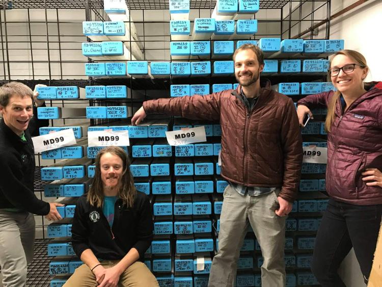
Simon Pendleton, David Harning, Chris Florian, and Sarah Crump take a break after moving sediment cores into a new storage facility.
Projects
Current projects
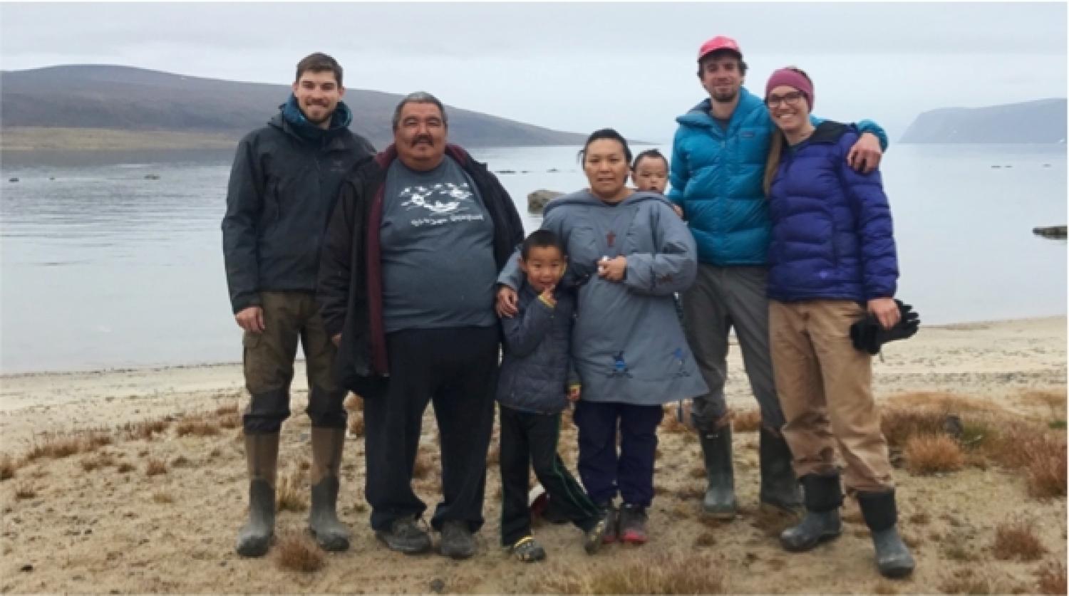
Greg de Wet (INSTAAR postdoc), Joshua Akavak (guide), Ina Akavak (Joshua's wife) with their children, Zach Montes (photographer, Orijin Media), and Sarah Crump (INSTAAR PhD student) by the Clyde River, Baffin Island.
The Arctic is warming faster than any other region of the planet, and the effects are already apparent. Landscapes that have been continuously ice-covered since the start of the last glacial cycle are now being revealed as ice recedes. What will these changes mean for the Inuit living there? How will vegetation change? Those are some of the questions that Giff Miller, Julio Sepúlveda, grad students Sarah Crump and Jon Raberg, and postdoc Greg deWet, along with colleagues at the University at Buffalo, University of Alaska Fairbanks, and Curtin University, are tackling under a new NSF-funded project, PACEMAP.
Capitalizing on lake sediment deposited in past warm times across the eastern Canadian Arctic, including the Early Holocene, the Last Interglacial (MIS 5e), and the penultimate interglacial (MIS 7), our field teams recover pristine, continuous sedimentary archives that capture these warm intervals. We are using molecular approaches to reconstruct changes in climate, hydrology, and vegetation through past warm times. Julio, Greg, and Jon are using bacterial membrane lipids, called branched glycerol dialkyl tetraethers (brGDGTs), to reconstruct climate back through time. The distribution of these compounds in modern environments has been empirically shown to track environmental temperature, and one of the goals of the project is to create a calibration for Arctic Canada. Sarah, working with Mike Bunce at Curtin University, is using ancient sedimentary DNA extracted from interglacial sediment to provide a more authentic reconstruction of local vegetation communities, where long-distance pollen dispersal compromises pollen records. This approach, relatively untested on such long timescales, also involves modern validation work, where ecologists working with Skip Walker (CU PhD) at UAF, map the modern vegetation around our study sites to compare with DNA extracted from surface sediments.
Our goal is to derive algorithms that will allow us to predict the evolution of Arctic vegetation by 2100 CE using summer temperature estimates from climate models under various future emissions scenarios. In 2019 we will deploy five field teams collecting sediment cores and mapping modern vegetation along a transect from the forest-tundra ecotone to polar desert sites in Canada's far north.
Overview
An eggshell of the extinct Genyornis from central Australia, part of a series of shells representing more than 100,000 years of geochronology. Geochronological and isotopic research on the shells helps lab members evaluate ecosystem changes and the timing of megafauna extinction in Australia.
The timing and cause of the extinction that killed all animals heavier than 60 kg in Australia has been elusive. Using ratites' (flightless birds) eggshells, we have been able to narrow the time window of the extinction to 50,000 +/- 5,000 years ago. Other research has since supported our age estimate for this extinction (Roberts et al., 2001). We have also used the eggshells of these birds to understand dietary changes through time and from region to region. Stable isotopes of carbon, nitrogen and oxygen are preserved in the crystal matirx of the eggshells and present us with a proxy of diet. Based on the evidence to date, our hypothesis is that after human colonization of Australia (60,000 years ago), the ecosystem changed due to over-burning of the landscape. This would have reduced evapotranspiration over the interior of the continent, thereby increasing aridity and eliminating food supplies for the large animals.
Australia's mass extinction
What caused an extinction in Australia during the late Pleistocene? Climate change? Human impact? When exactly did the extinction occur?
An emu nest with eggs.
Although most elements of the biota modify their environment, only humans deliberately modify their environment to meet perceived needs. In prehistoric times, controlled use of fire was the most effective tool for landscape modification. Unlike Africa and much of Eurasia, where there was a long adjustment period as human tool kits and social structures evolved, the Americas and Australia were only colonized after the appearance of H. sapiens sapiens. In these regions more dramatic impacts may have occurred following human arrival.
Our research focuses on the impact of Pleistocene colonization of Australia by modern humans. We hypothesize that their burning activities destabilized ecosystems across the interior such that a large segment of the dependent fauna became extinct, and that this ecosystem change ultimately led to reduced effective moisture over the interior. By combining tightly focussed field campaign to acquire primary collections, and a coordinated analytical program for these samples concentrating on their physical characteristics, geochronology, and d13C as a paleovegetation proxy we aim test specific predictions of our hypothesis.
Emu eggs in the nest.
Through the years, our research has developed a continuous time-series of eggshells of two large flightless birds, the extant emu (Dromaius) and the extinct Genyornis from several sites across central Australia. More than 100,000 years of eggshells are represented in each collection. From these time-series we can evaluate the timing of megafauna extinction, and from the isotopic records of diet (vegetation) preserved in the eggshells, we can evaluate ecosystem change and test whether systematic shifts in diet occurred as Genyornis approached extinction. We can also measure d13C in biomarkers for terrestrial vegatation extracted from long (100,000 years), continuous sediment records in NW Australia to evaluate whether changes in regional vegetation occurred following human colonization.
By evaluating the diets of Dromaius and Genyornis, we aim to determine the cause of the megafauna extinction. If the cause of the extinction was human predation, we would not expect to see a dietary shift (a shift in vegetation). However, ecosystem collapse might be recorded as a change in diet. Precise geochronology is essential in addressing the timing and cause of this extinction, therefore we employ state of the techniques to meet this requirement (amino acid geochronology, optically stimulated luminescense dating and uranium-thorium dating).
A shard eggshell of the extinct Genyornis from central Australia.
Traveling to our research site.
A scanning electron micrograph of an oogonium. The carbonate shell is broken, revealing the oospore.
Overview
Charophytes, a type of green algae, are prevalent both in the modern and fossil lacustrine environments of Australia and elsewhere. They generally tolerate a wide range of water conditions, which might explain their ubiquity. Some species (e.g., Lamprothamnium papulosum) create a calcareous shell (oogonium) around the female gamete (oospore). These shells are about the size of coarse sand, but are fairly robust for their size and manage to preseve well in the fossil record. This project aimed to determine if oogonia are a viable source of sample material for amino acid geochronology. The racemization rate for each amino acid in a given taxon must be calculated in order to understand the age or thermal history of a sample. So, this was a primary thrust of the project. Then, site-specific chronologies and thermal histories were hoped to be calculated, which would give us more insight into the lake level histories in central Australia. In short, oogonia do not appear to be extremely useful for amino acid geochronology due to wide ranges of D/L ratios and amino acid concentrations within a single stratum. Furthermore, D/L ratio and concentration do not appear to be related. This translates to enormous error bars associated with age or paleotemperature estimates.
Charophyte oogonia and amino acid geochronology
The summer monsoon is one of the primary sources of moisture over the semi-arid regions of central Australia. Often, dry lakes in the interior of Australia are used to reconstruct the timing and the intensity of monsoons in the past. Investigation of the stratigraphy surrounding these lakes shows that elevated shoreline deposits demarcate these prior highstands. A lack of suitable material for dating techniques has hampered our understanding of the exact timing of these monsoonal shifts.
Here I've used charophyte oogonia, the calcified algal fruiting bodies found in shallow lacustrine sediments, as a new sample material for amino acid geochronology. Improved instrumentation now allows the use of extremely small samples (~0.01 mg), reducing the required sample size and therefore enabling higher sampling precision of lacustrine sediments (e.g. beaches, lake cores). An assessment of sample quality regarding charophyte oogonia was made and several applications of amino acid racemization using these algae were explored. The majority of the oogonia analyzed in this experiment displayed random D/L variability between subsamples from the same stratum despite high levels of analytical reproducibility (< 8% variation). The concentration of amino acids in oogonia was investigated as a potential source of this D/L variability, but there was no correlation between the two parameters. It is this variability which hampered nearly all chronologic reconstructions based on amino acid racemization.
The dots on the map show general sampling regions for the charophyte study. The two southernmost dots were locations containing modern samples (Coorong Nat'l Park and lakes near Robe). The three northward sites primarily contained fossil oogonia. Hundreds of samples were collected from these locations, most of which have been analyzed via reverse-phase liquid chromatography.
A satellite image of Lake Eyre in flood. During several periods of increased monsoon intensity over the last 125,000 years, Lake Eyre contained at least this much water perennially.
A satellite image of a dry Lake Eyre. Once the lake dries after an extended period of lake-full status, sediments are left behind which often contain charophyte oogonia.
Ice sheets are an integral part of the earth’s climate system, but the chronology and dynamics of Pleistocene ice sheets is in most places only loosely constrained. In the eastern Canadian Arctic, for example, the history of the northeastern Laurentide Ice Sheet (LIS) during the Last Glacial Maximum (LGM) is only known in selected regions, but is extrapolated to broader areas. More than 160 cosmogenic exposure ages from the Clyde Region, northeastern Baffin Island, reveal that the northeastern LIS was more extensive and dynamic than previously depicted. Tors on weathered uplands surrounding Clyde Inlet are covered with perched erratics that have cosmogenic exposure ages of 20-10 ka, indicating that the uplands were glaciated by cold-based, non-erosive ice during the LGM. In contrast, warm-based, erosive ice probably occupied Clyde Inlet throughout the LGM, indicating strong gradients in basal thermal regimes and the operation of an ice stream in Clyde Inlet. In the most distal sectors of the Clyde Foreland, where cold-based ice hardly modified the landscape, erratics yield a multi-modal exposure age distribution that may indicate numerous advances and retreats of cold-based ice across the foreland throughout Marine Isotope Stages 3 and 2. Ice retreated from the Clyde Foreland ~13 ka, from the mouth of Clyde Inlet ~12-10 ka, and had reached the fiord head by ~8.3 ka. Upland tors surrounding outer Clyde Inlet have single-nuclide apparent exposure ages >60 ka. However, paired 26Al and 10Be concentration data reveal that they are at least several hundred thousand years old, indicating that while the uplands have been covered by ice off and on throughout the Quaternary, they have only been slightly modified.
These new data depict an extensive LIS in the Clyde Region during the LGM, possibly terminating at the continental shelf break beyond Clyde Inlet. Strong gradients in basal thermal regimes suggest highly variable patterns in glacier thickness, velocity, and erosion, an overall pattern indicative of ice stream activity. A northeastern LIS this dynamic and extensive would have been closely linked with fluctuating ocean circulation and sea level.