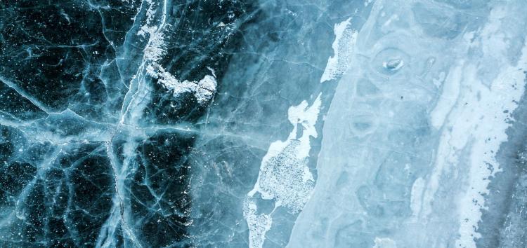
Scientists aim to fuse Earth data to help classify, map sea ice
CU Boulder geographer leads colleagues from National Snow and Ice Data Center and CU Denver in effort to leverage artificial intelligence for harmonizing large earth observation datasets and mapping sea ice
Earth-orbiting satellites and other instruments collect huge amounts of data, each providing a different lens through which scientists can map the environment. Some instruments measure reflections of visible light or radar waves, while others measure elevation.
These diverse observations need to be harmonized and combined for studying the Earth’s surface. But the sheer size and differences in the data pose a challenge to this synchronization—one that researchers at the University of Colorado hope to tackle with the help of artificial intelligence (or AI).

Morteza Karimzadeh
The researchers’ project, called “Harmonized Earth,” is led by Morteza Karimzadeh, assistant professor of geography at CU Boulder, and his collaborators at the National Ice and Snow Data Center (NSIDC) and CU Denver’s Department of Computer Science.
Harmonized Earth recently won a three-year, $1.2 million grant from the National Science Foundation to create algorithms and cyber-infrastructure for harmonizing heterogeneous big-data products including satellite imagery and in situ, or on site, observations in a cloud computing environment.
The technologies developed by the Harmonized Earth project are expected to be useful to a variety of applications including for climate change research as sea ice is a key indicator. For this NSF-supported effort, however, the focus will be on creating high-resolution maps of sea ice extent and thickness, a challenging scientific task, according to the researchers, due to the elusive and constantly changing nature of sea ice.
With the increasing availability of high-resolution remote sensing products such as synthetic-aperture radar and lidar technology, there is a renewed desire for tackling this challenge, scientists note.
However, bridging data science and geoscience together is key in successfully harnessing these large heterogeneous data for sea-ice mapping, Karimzadeh said, adding:
“This project brings geospatial data scientists, geoscientists, and computer scientists to tackle this challenge using the state-of-the-art in machine learning and earth observations for seamless data fusion, machine learning and analysis.”
Karimzadeh noted that one challenge to using AI to fuse data for sea-ice mapping is that AI relies on data labels created by humans.
“Our goal is to create efficient infrastructure for minimal human effort in labeling these huge datasets across different types,” Karimzadeh said, adding: “The algorithms then ‘learn’ from these labels in an interactive manner.”
Walt Meier, senior research scientist at NSIDC and a member of the research team, concurred, adding that another area where Harmonizing Earth could provide benefit is the creation of ice charts for human activities in and near sea-ice regions. Now, that effort is largely done manually, “experts looking at images and interpreting where there is ice,” and because it is manual, it is difficult to analyze much data from synthetic-aperture radar, he said.
“Our methods will help automate much of this process, which will allow much more data to be analyzed for the ice charts and improve those charts,” Meier added.
NSIDC scientist Andrew Barrett commented that machine-learning methods such as deep neural networks could help scientists map larger areas at high resolution.
“Ice analysts can then focus on checking, correcting and packaging ice maps for users in a similar way to how meteorologists use output from numerical weather prediction models along with other sources of information to produce weather forecasts,” Barret said.

On a broader scale, Meier said, better interpretation of different kinds of data “will help us better understand how sea ice changes seasonally and over the years to give us better sense of how the ice cover is changing and improve models to understand how it will change in the future.”
Harmonized Earth will be integrated into NSF’s EarthCube software ecosystem for maximum adoption and ease of use, to make federally funded data more useful to researchers, including those who make sea-ice projections used by the shipping industry.
Our methods will help automate much of this process, which will allow much more data to be analyzed for the ice charts and improve those charts."
To that end, Karimzadeh noted that the project also aims to produce “computational notebooks” for students with little or no background in data-science methods in geoscience.
EarthCube is a growing community of scientists from the geosciences, as well as geoinformatics researchers and data scientists. It began as a joint effort between the NSF Directorate for Geosciences and the Division of Advanced Cyberinfrastructure and has attracted an evolving, dynamic virtual community of more than 2,500 contributors, including Earth, ocean, polar, planetary, atmospheric, geospace, computer and social scientists, educators and data and information professionals.
Through this community-driven development, many successful open-source projects have been made available to researchers and practitioners, and Harmonized Earth will add earth data fusion and sea ice mapping to the capabilities of EarthCube.
Harmonized Earth is a collaboration between Principal Investigator Karimzadeh, Andrew Barrett, Walt Meir and Siri Jodha Khalsa of NSIDC; and Farnoush Banaei-Kashani of CU Denver Computer Science.
The project, “Data Capabilities: Enabling Analysis of Heterogeneous, Multi-source Cryospheric Data,” is described in Award #2026962 and Award #2026865.

