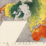
Learn more about our collection of over 200,000 maps,  geospatial data, and GIS and data visualization support. 

National Rifle Association “Pictorial Wildlife and Game Map of the United States,” 1972 showing illustrations of animal spaces across the US

Mapping from ‘Description to Analysis’

Jan. 17, 2024

To Program for Writing and Rhetoric (WRTG) Teaching Associate Professor Rebecca Dickson, maps are an avenue for making a good argument. WRTG regularly partners with the Earth Sciences & Map Library to explore how maps can facilitate new ways of learning for first-year students.

The Dymaxion Map

The legacy of Buckminster Fuller and the Conference on World Affairs

July 19, 2023

Buckminster Fuller, the creator of the Dymaxion Map Projection, spoke at the 1956 Conference on World Affairs. Then he gave CU Boulder a signed map. Learn about him and the humanitarian purpose of his famous map projection, in our World of Printed Maps series.

Black History Month: Honoring Louise E. Jefferson

Feb. 20, 2023

Highlighting a recent acquisition to our collections and honoring Louise E. Jefferson – a Black cartographer, artist, photographer, illustrator, calligrapher, and leader.

Detail of Diné Bikéyah Navajo Lands Map

The World of Printed Maps: Indigenous place name maps

Feb. 6, 2023

This month, we feature maps that honor the names and languages of native peoples.

Pageant of the Pacific map

The World of Printed Maps: Pictorial maps

Jan. 13, 2023

The World of Printed Maps is a regular feature that showcases the physical maps collection in the Earth Sciences & Map Library.

The GID Day logo on a photo background

Discover the world on GIS day with the University Libraries

Oct. 19, 2021

On Nov. 12, the University Libraries is partnering with Auraria Library, University of Colorado Denver and the University of Colorado Colorado Springs to host a hybrid GIS Day symposium.

GIS Day Logo

Celebrate GIS Day with the University Libraries

Oct. 20, 2020

Join the University Libraries and celebrate GIS Day with a virtual mini-conference on November 13! Geographic Information Systems (GIS) is a scientific framework for gathering, analyzing and visualizing geographic data. Geospatial technology is crucial to making decisions about our infrastructure, natural resources and economic growth. It has also become an...

CU Historical Aerial Photo Collection online map screen shot

Provost Fellow Jaffe develops open source code for georeferencing aerial photos collection

July 1, 2020

Sarah Jaffe, a PhD student in CU Boulder’s Environmental Studies program, developed a workflow for the libraries to transform the Earth Sciences & Map Library’s historical aerial photos into a massive collection of geographic information system (GIS) data for researchers.

Sanborn Fire Insurance web map index of Colorado Springs in the early 1900s.

Libraries Fellow Buddy Collins Indexes Essential Collection for Map Library

May 4, 2020

Buddy Collins, a graduating senior in the Department of Geography and this year’s Friends of the Libraries Fellow, has spent the last few months improving access and discovery to the Earth Sciences & Map Library’s Sanborn Fire Insurance Map Collection . His work creating web map indexes for this important...

An interdisciplinary class in the Map Library.

Map Librarians Connect Classes with Maps

Jan. 3, 2020

As you walk downstairs to the map collection of the Earth Sciences & Map Library, you may find a room full of students and the chatter of discovery surrounding maps. The number of classes held in the Map Library has been steadily increasing, due to the team spirit of Map...

Pages