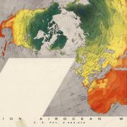
The Map Collection, located in the Jerry Crail Johnson Earth Sciences & Map Library, consists of an estimated 200,000 maps, over 3,000 atlases and geographic reference books, and more than 25,000 Colorado historical aerial photographs covering a broad range of subject areas, including geography, geology, history, architecture/urban planning, environmental studies, genealogy, travel and recreation.
A regional depository of the Federal Depository Library Program, we house the maps received from agencies such as USGS, BLM, U.S. Forest Service, Department of Transportation, NGA (formerly NIMA, DMA, and AMS) and CIA.
Most Map Collection materials can be checked out (information about visiting and using our collections). We offer research guides, tours and in-person and virtual instruction. For more information or general inquiries, please contact us at rad@colorado.edu.


