The Jerry Crail Johnson Earth Sciences & Map Library, located in the Benson Earth Sciences building, offers materials in Earth and Environmental Sciences, Geology, and Physical Geography including maps, GIS and data visualization support and geospatial data. 

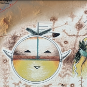
Detail of Diné Bikéyah Navajo Lands Map

The World of Printed Maps: Indigenous place name maps

Feb. 6, 2023

This month, we feature maps that honor the names and languages of native peoples.

Pageant of the Pacific map

The World of Printed Maps: Pictorial maps

Jan. 13, 2023

The World of Printed Maps is a regular feature that showcases the physical maps collection in the Earth Sciences & Map Library.

A student walking in front of Norlin on a snowy day

Student support guide for Spring 2023

Jan. 12, 2023

Access our collections and resources and get help through Ask a Librarian.

A man standing on a glacier.

Listen to stories of climate change in the Arctic

Oct. 28, 2022

The Earth Sciences & Map Library will host a panel discussion where explorers, scientists and artists who’ve witnessed climate change in the Arctic will share their stories.

How to date a rock exhibit

You can now learn “How to Date a Rock” at the Earth Sciences & Map Library

Oct. 12, 2022

It’s the latest in a series of student-curated exhibitions hosted by the University Libraries this semester.

An image of ice from the exhibit.

Earth Sciences & Map Library to host ‘Sensing Ice: Explorations of Knowing Nature’ exhibit

Jan. 18, 2022

The exhibit invites viewers to contemplate the evolving human relationship with the ice on our planet.

A snowy Norlin facade.

Faculty support guide for Spring 2022 remote start

Jan. 5, 2022

Submit requests for digital versions of your course materials, access the Libraries’ services and collections, and see our hours and open locations.

GIS Day Logo

Celebrate GIS Day with the University Libraries

Oct. 20, 2020

Join the University Libraries and celebrate GIS Day with a virtual mini-conference on November 13! Geographic Information Systems (GIS) is a scientific framework for gathering, analyzing and visualizing geographic data. Geospatial technology is crucial to making decisions about our infrastructure, natural resources and economic growth. It has also become an...

CU Historical Aerial Photo Collection online map screen shot

Provost Fellow Jaffe develops open source code for georeferencing aerial photos collection

July 1, 2020

Sarah Jaffe, a PhD student in CU Boulder’s Environmental Studies program, developed a workflow for the libraries to transform the Earth Sciences & Map Library’s historical aerial photos into a massive collection of geographic information system (GIS) data for researchers.

(Sky Pond/Ansh Desai)

Ansh Desai Wins Earth Sciences & Map Library Photo Contest

June 8, 2020

The University Libraries are pleased to announce that CU Boulder undergraduate student Ansh Desai has won the 2020 Earth Sciences & Map Library Photo Contest! Desai’s photo Sky Pond was taken in late May 2019 during a sunrise hike to one of Rocky Mountain National Park’s best-kept secrets. ( Sky...

Pages