Next time you walk west from the Norlin quadrangle, take note of the mysterious irrigation ditch. It captures the wild waters that flow from the mountains into Boulder.
The irrigation infrastructure of the Boulder Valley offers a local view into the complicated relations between people and the West’s most precious natural resource, water.

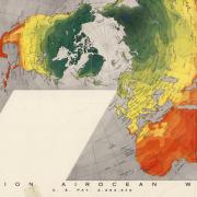
Photo by Andrew Violet
The University Libraries Earth Sciences & Map Library contains irrigation maps of the Boulder Valley from the 19th to the 21th centuries, ground water atlases and historical aerial photography all following the movement of water relative to topography and human intervention.
What to know about Colorado’s water
Most of Colorado is semi-arid, the majority of its precipitation falling as snow in the mountains and melting throughout the summer. Although irrigation was widely used by Indigenous peoples of the Southwestern United States, the only surviving archaeological evidence we have in what would become the State of Colorado is at Mesa Verde.

Mesa Verde (left) Larry W. Mays; San Luis People’s Ditch (right) Jfleck
The historical record of ditches in Colorado begins with the San Luis People’s Ditch, established on April 10, 1852 by Hispanic settlers. Situated in the San Luis Valley, the ditch continues to be managed by the local communal system, originated in Spain, called an acequia. (To learn more see Acequia Assistance Project)
Where Boulder is situated
The Boulder Valley is within the South Platte River Basin, a 24-square mile area where some 70 percent of the population of the State of Colorado live. Surface waters flowing down from the front range mountains in this area all eventually converge out east in Nebraska to become tributaries to the Platte River.

Ground Water Atlas of Colorado
Our local wild waters
Six streams drain onto the plains of Boulder County. North Boulder Creek flows through the center of Boulder, the South Boulder Creek out of Eldorado Canyon. Left Hand and St. Vrain creeks emerge from the foothills north of Boulder, Coal and Rock creeks to the south. This 1941 image from the library’s collection of aerial photography shows the topography carved by Boulder Creek.

The humble ditch
Irrigation ditches are human-made channels that draw from natural water sources. The flow of water is controlled by a ditch company, often activated through a single individual called the ‘ditch rider.’ Most ditches in Boulder County are active from April to October, with a few that run through winter. Essential for agriculture, ditches are also used to irrigate parks, schools and open spaces. Some carry municipal water owned by the city.
Some of the oldest ditches in the Boulder valley were dug out by ox-driven plows and many of these are still operating. What has changed many times over, reflective of the increased need for water and advances in technology, is the meticulous mapping of these same ditches.
Following the discovery of gold in the Front Range, the first registered irrigation ditch was established in the Boulder Valley in 1859, the Smith & Goss Ditch. Water delivered through this system is still used to irrigate portions of central Boulder that include Boulder High School, Naropa University and the University of Colorado Boulder, but it is not easy to locate today.

The above map was generated for the 2009 Boulder Ditch Project by City of Boulder Open Space & Mountain Parks and is one of the few that accounts for the short, and now largely underground, Smith & Goss Ditch. We recommend you go to the project’s interactive map to find it online and then try to find it on foot.
Thirsty plains

City of Boulder Irrigation Ditch FAQ 2016 from downloadable PDF
As the population of Boulder expanded, so did the need for water. Maps of the Boulder Valley from the 19th century to the present day illustrate the attention devoted to negotiating water rights, land ownership and agriculture.

Farmer’s Ditch, established in 1862, is represented in each of the above maps. It extends seven miles and has an irrigation capacity of 1,500 acres.
You can explore the 1887 Willits maps in print or view it online through the CU Digital Library. Also available online are Colorado Sanborn Fire Insurance maps, and for a contemporary look at Boulder Valley’s irrigation systems, the 2018 county map.
See the book Digging the Old West: How Dams and Ditches Constructed an American Landscape available at the Earth Sciences & Map Library
See the From Desert To High Plains Oasis on the Boulder County Parks & Open Space site, and at the History Colorado site, Agricultural Resources of Boulder County
For more about the San Luis People’s Ditch check out this story by NPR’s KUNC