One recipe for enduring love: Wes and Linda, a typewriter and a 1902 map of Colorado.

The old map was priced at $15 and Wes Brown didn’t have it.
Neither did his new girlfriend, Linda Frey, a recent transfer student from Chicago.
This was fall 1973.
The pair had met in class, introductory economics. She was shy. His hair was long. She sat near him. He started a conversation.
It was pretty much love at first sight.
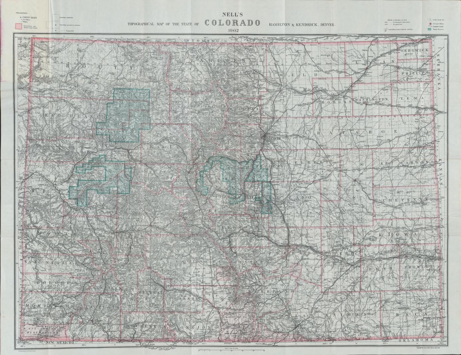
Wes (Econ’76) was into maps, and he took Linda (Psych’76) to see one he’d fallen for at a Pearl Street book and print shop — a 1902 Nell’s pocket map of Colorado. They admired it and went on with the day.
Afterward, Linda did what any love-soaked teenager might: “I hocked my typewriter.”
It was an electric Smith Corona, the one she used for school, and it fetched just enough at a local pawn shop to meet the need.
She returned to the store, Stage House II, bought the map and gave it to Wes for Christmas.
He hung it in his apartment, beside the Jimi Hendrix and Led Zeppelin posters.
Later, during a long career in investment banking, he displayed it in his offices.
Over the decades, Wes — Linda’s husband since 1979 — built a major map collection, now said to be the world’s best private trove of antique maps of Colorado and the Intermountain West. (The Denver Public Library, a favorite haunt, has a bigger and better collection, he said.)
Among his treasures are an 1810 Zebulon Pike map that was the first to show any part of Colorado; an 1862 Frederick Ebert map that was the first detailed survey of the state; and the first aerial view of Boulder, from 1874 — one of two known copies.
He also owns maps of other parts of the world, including a 1511 Pieter Martyr map of the Caribbean, the first map of the “New World.”
Lately he’s become interested in 17th- and 18th-century Spanish maps of the American Southwest.
“It’s the history of exploration that I find fascinating,” he said. “A map is a vehicle to understand the history of exploration.”
The map that started it all — the 1902 Nell — recently returned to Boulder for good: Last summer, after noticing it would fill a hole in CU Boulder’s primary map collection, and having acquired a second copy and run the idea by Linda, Wes offered it to the university.
“What better place for it to permanently reside than in the city it was lovingly purchased 45 years ago,” Wes said, quoting Linda.
 Wes’ interest in maps was practical at first. As a teenager, he discovered mountain climbing. Maps helped him plan and navigate his trips.
Later he began poking around antique shops with a high school friend who liked old things. Many of the shops carried maps, often pages from 19th-century atlases of the United States. They described a world at once familiar and foreign.
By the time Wes arrived at CU, he said, “I was totally crazy for old maps.”
Around the time he met Linda, he came across the 1902 Nell.
Louis Nell emigrated to the United States from Germany in 1865, according to Wes’ own research. Trained as a civil engineer and surveyor, he spent most of the 1870s helping the federal government chart the American West.
In 1880, Nell began printing and selling his own highly detailed maps of Colorado. He updated them often through 1907, operating out of an office on Larimer Street in Denver.
The maps, which came folded inside hard covers, stood out for their color, detail, precision, portability and durability. An early reviewer called them “a vast improvement both in style and in correctness…over anything heretofore published for sale in this country."
For the miners, railroaders, real estate speculators and other entrepreneurs of late 19th-century Colorado, they were ideal for navigating the landscape of a new and rough-hewn state.
“He ends up dominating” the Colorado map business for a quarter century, Wes said.
In all, Nell produced 19 different versions over 28 years, providing a detailed record of the state’s physical transformation in the first decades after statehood. Towns and cities emerge and expand. Some vanish. County boundaries morph. Railroads reach new places. Colorado matures.
Because Nell updated them often, viewers can trace small changes, useful today for scholars and students.
Over the years, about a dozen of Nell’s maps made their way into CU Boulder’s cartographic collections, housed primarily in the Jerry Crail Johnson Earth Sciences & Map Library.
Heavily focused on Colorado and the West and numbering more than 220,000 items in all, including about 1,500 antique maps, there are mining maps and railroad maps, topographic, geologic and political maps, town maps, insurance maps and road maps — most of them available for inspection without appointment.
A few years ago, map librarian Naomi Heiser began attending meetings of the Rocky Mountain Map Society in Denver. That’s how she got to know Wes Brown, who co-founded the group in 1991.
Heiser had always liked the Nell maps for their color and exceptional detail, but she didn’t know much about them, or about Nell, an obscure historical figure still. Wes filled her in.
With his encouragement, Heiser undertook a project to digitize the library’s Nells, making them available online for the widest possible audience.
When the work was done, she emailed Wes a link. He noticed that CU was missing the 1902 map.
The next time they met, over lunch on campus, Wes said he’d like to donate it.
“He surprised me with it,” said Heiser, who was moved as much by the backstory as by the gift itself.
“It was very precious to him, and he wanted us to preserve it,” she said. “It was very touching.”
As for Linda’s typewriter, she used her 1973 Christmas money to buy it back from the pawn shop, plus interest.
“I kept it for a long time,” she said. “But then an electric typewriter that could remember about 10 lines of copy came out and I got that. I think the Smith Corona went to Goodwill. Wish I still had it!”
Contact Eric Gershon at editor@colorado.edu. This story appeared in print (Winter 2018 issue) under the headline "Christmas 1973."
Nell’s topographic map of the state of Colorado, 1902 Image courtesy CU Digital Library; Photos courtesy Wes and Linda Brown
Related Articles

Mapping Afghanistan

The Spirit Moved Him

